Stream/Lines
Mary Miss / CALL
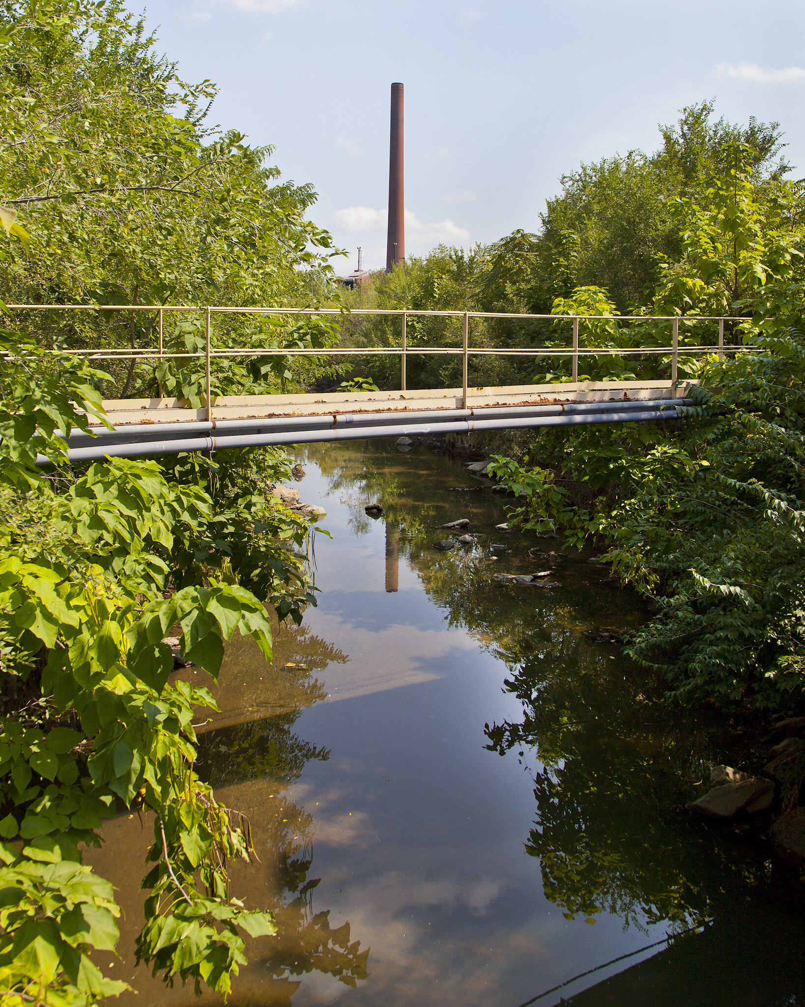
2014-2017/ The White River, Indianapolis, In
Stream/Lines fostered curiosity and exploration of the Indianapolis waterways. The project’s conceptual framework and visual components were conceived and designed by artist Mary Miss to highlight the major tributaries of the White River through contextual, immersive, and game-like experience of the sites and their unique characteristics. StreamLines has been made possible by a $2.9 million grant from the National Science Foundation (NSF), Advancing Informal Science Learning Program (AISL).
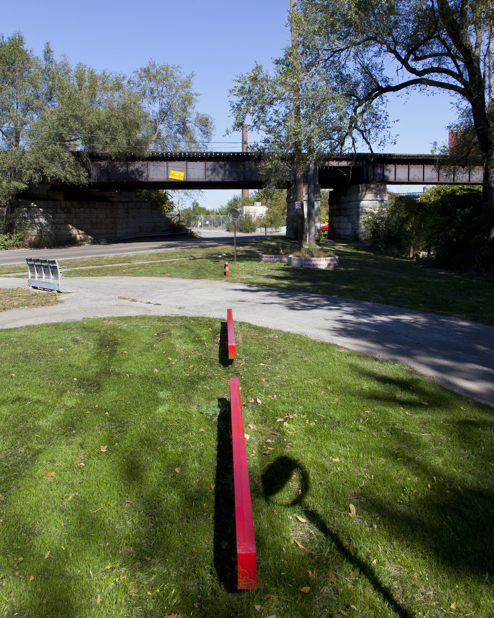
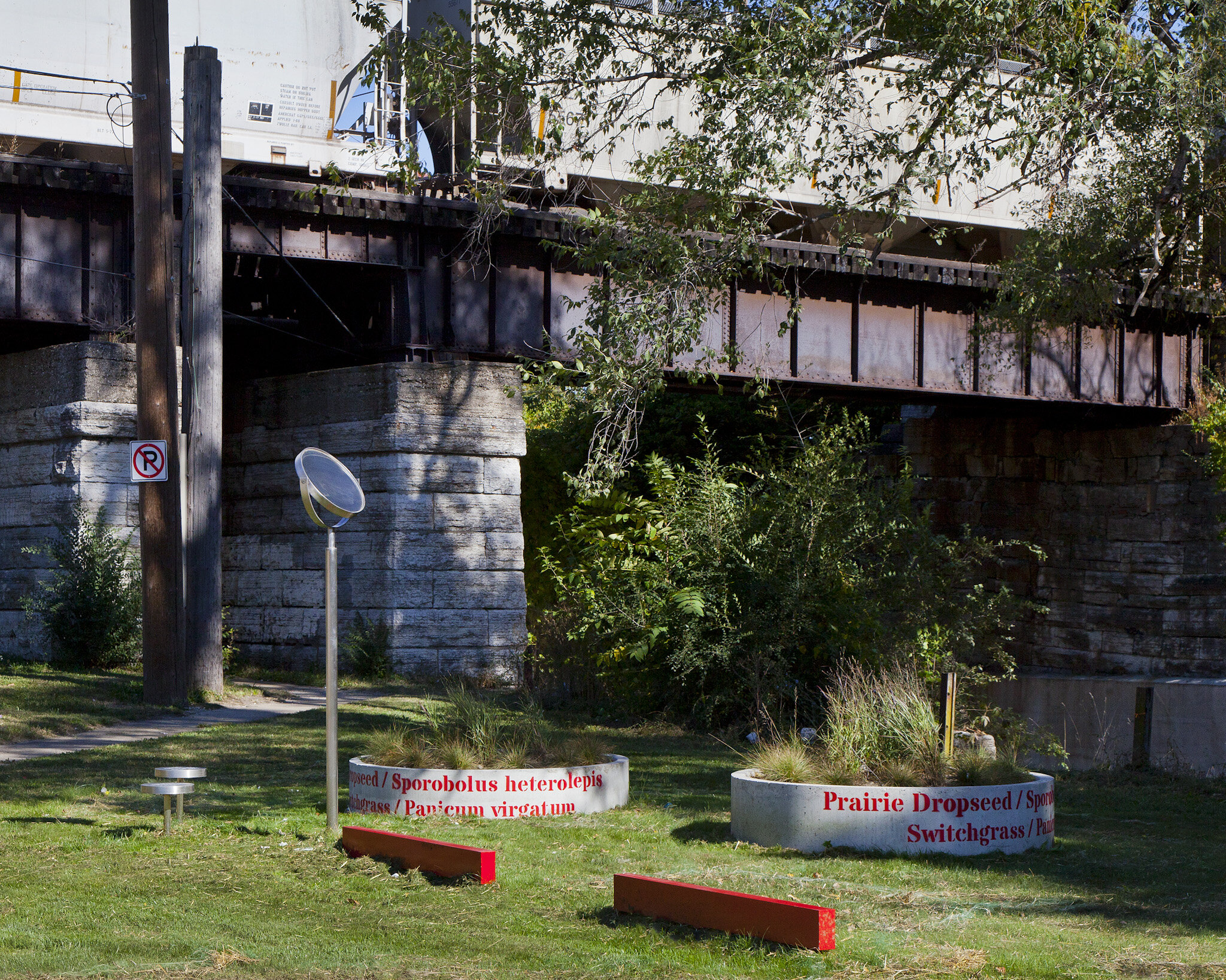
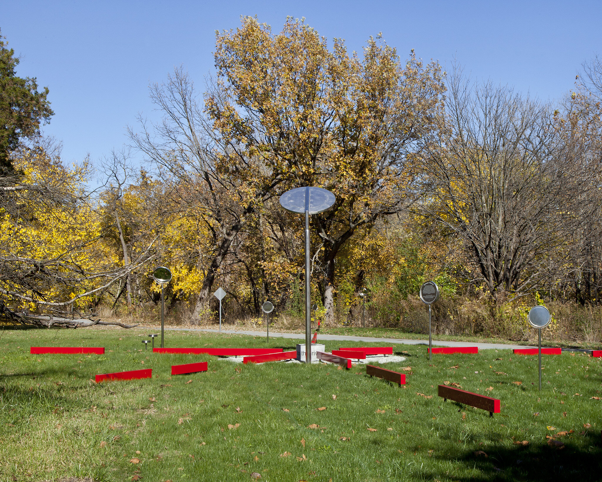
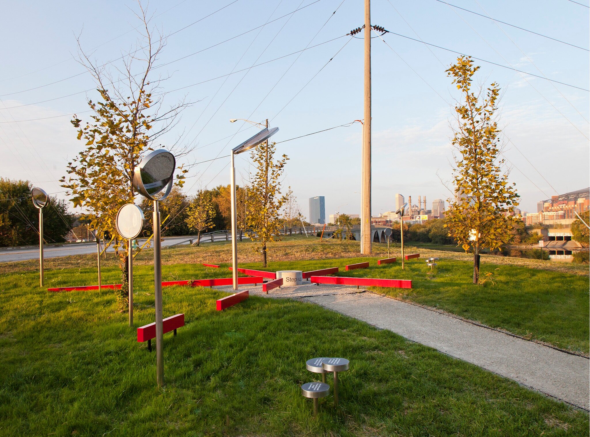
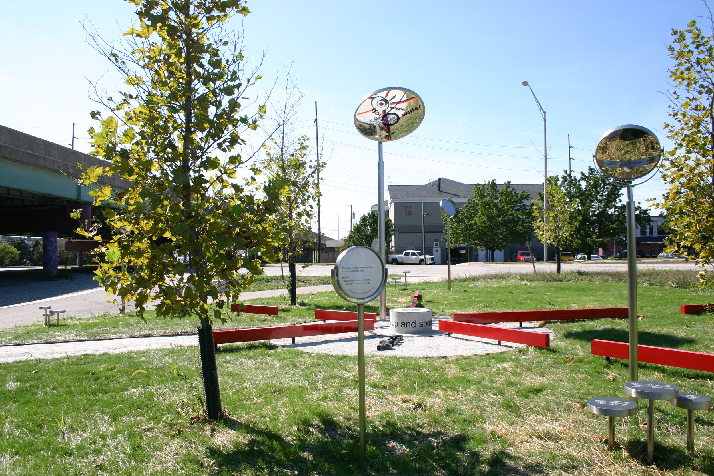
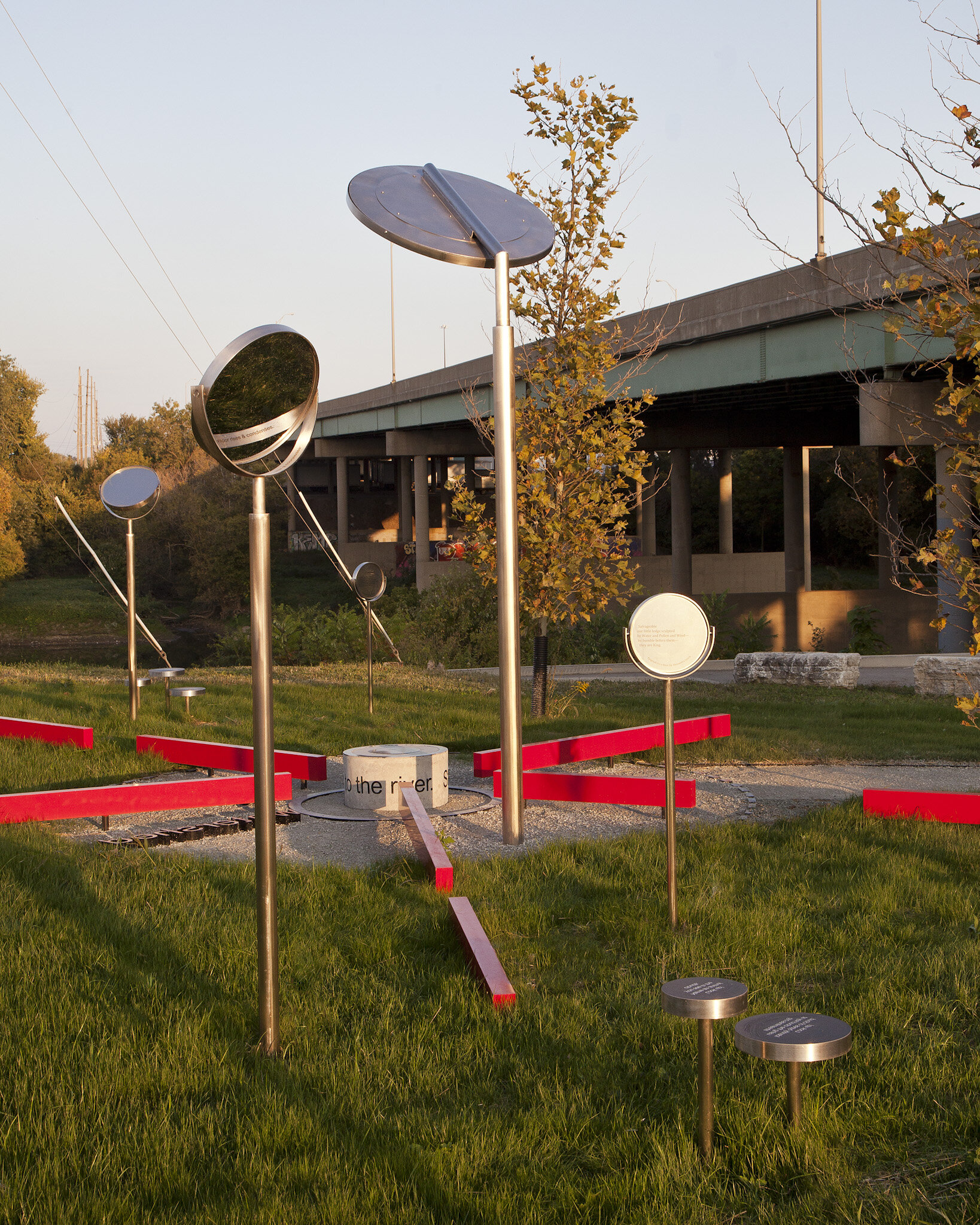
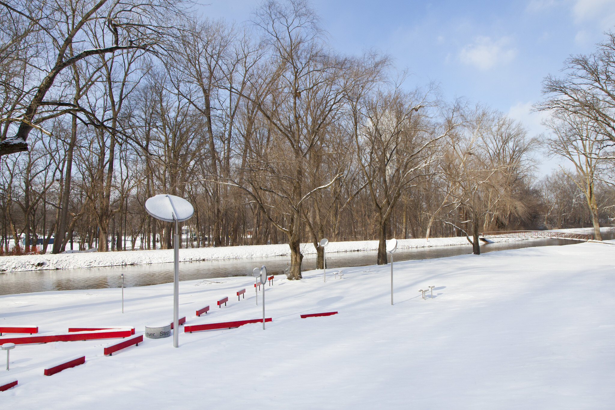
Stream/Lines was situated on five sites, in diverse communities along tributaries of the White River. Miss’ sculptural elements revealed the natural systems and infrastructure that impact the Indianapolis waterways and encourage exploration of the area. Located in residential and industrial neighborhoods, the sites were selected in partnership with Indianapolis citizens participating in the ROW (Reclaiming Our Waterways) initiative.
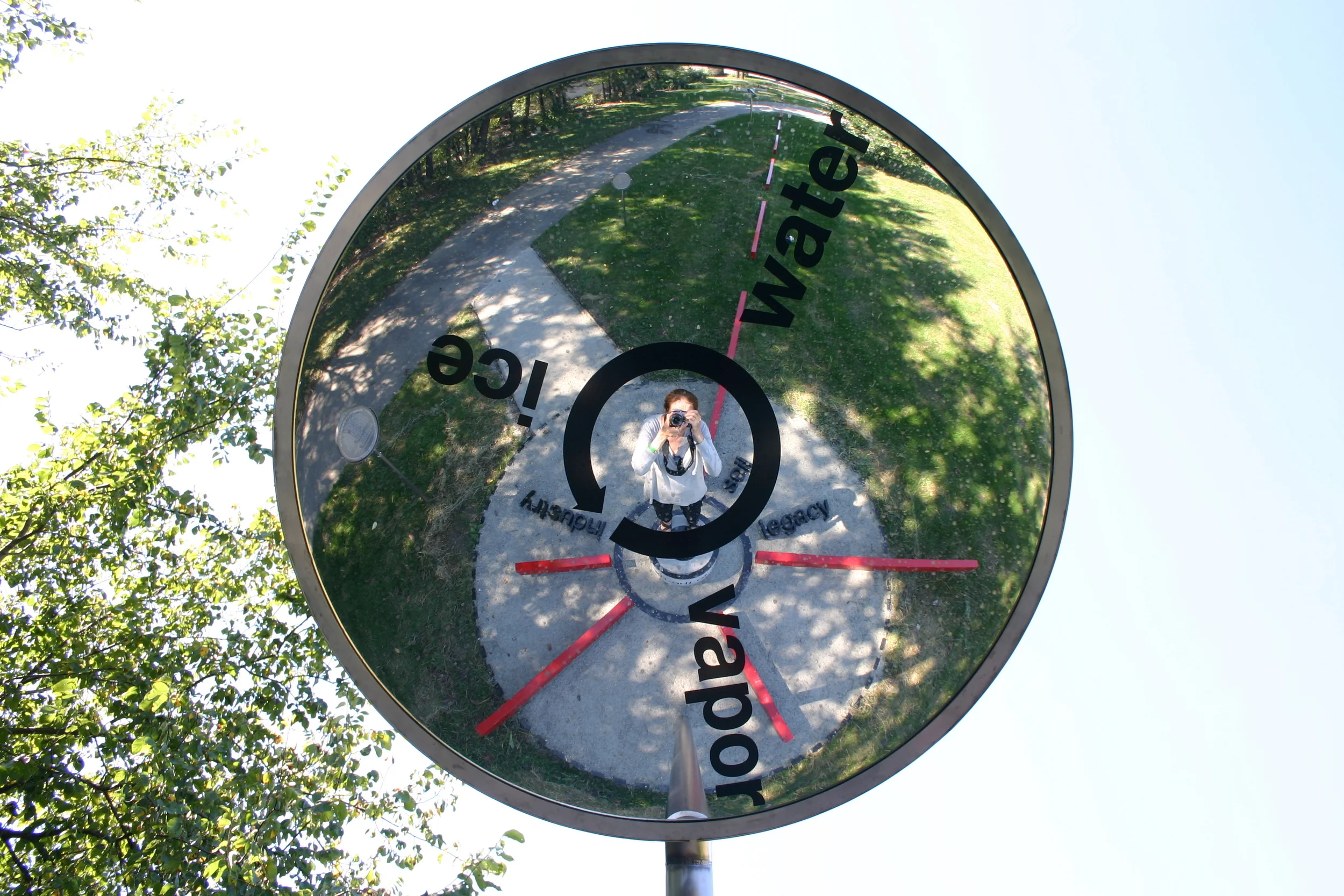
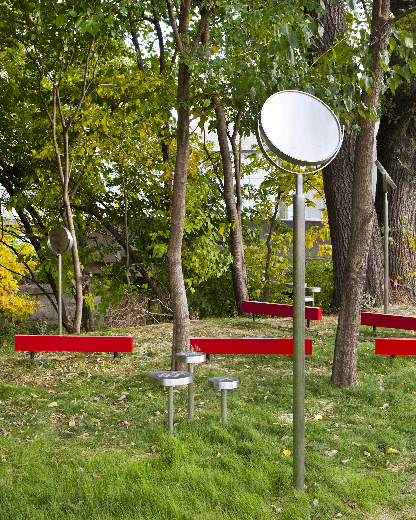
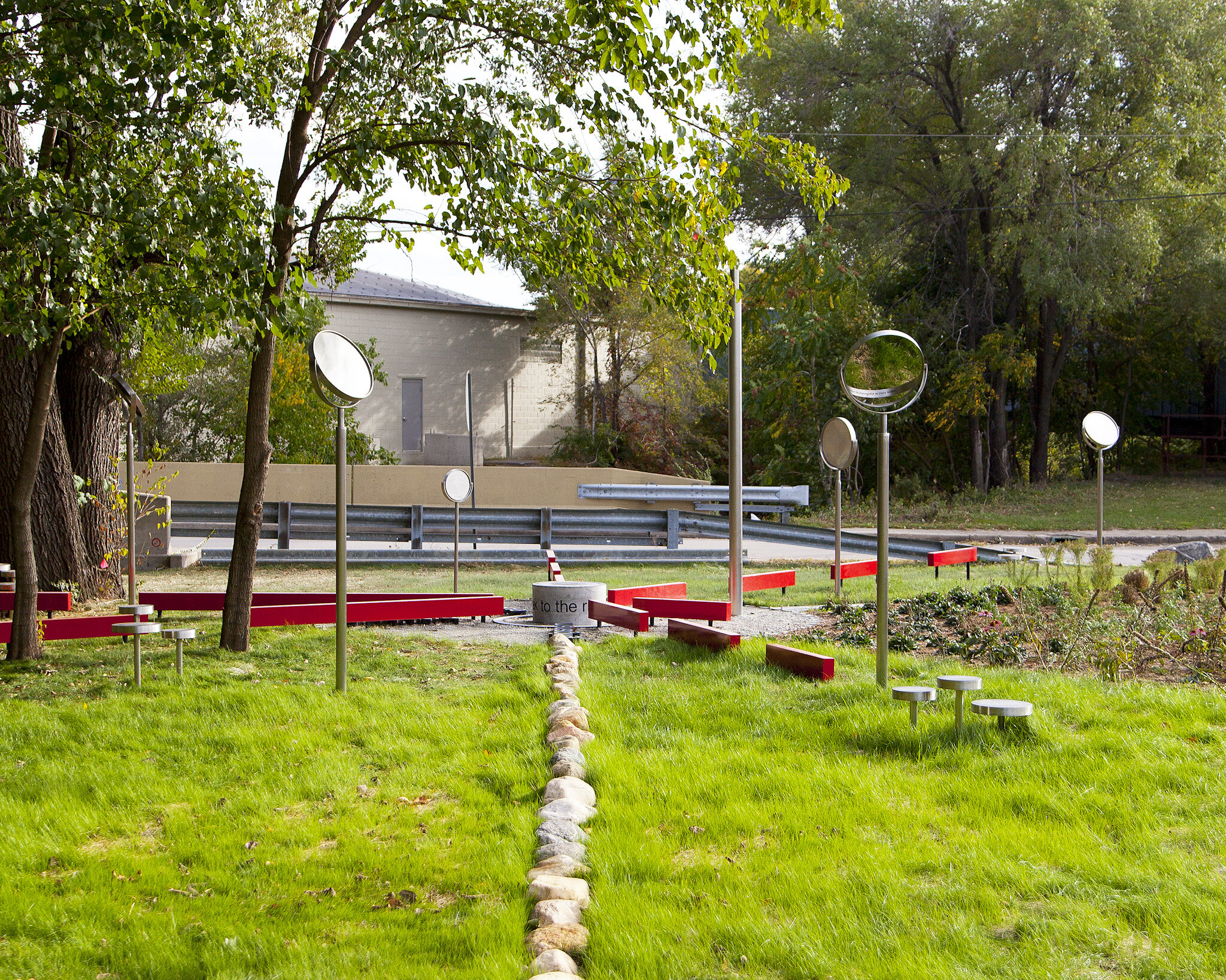
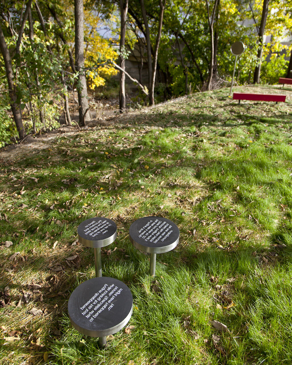
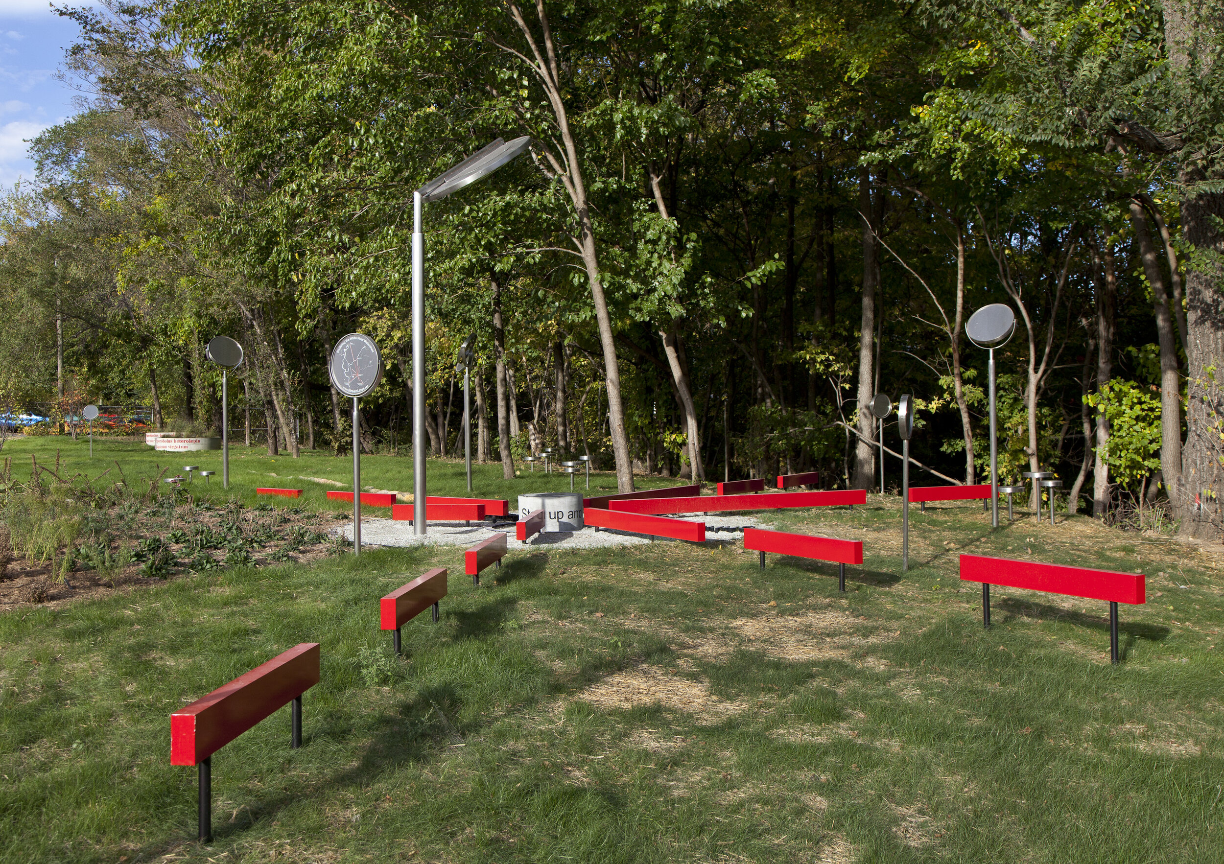
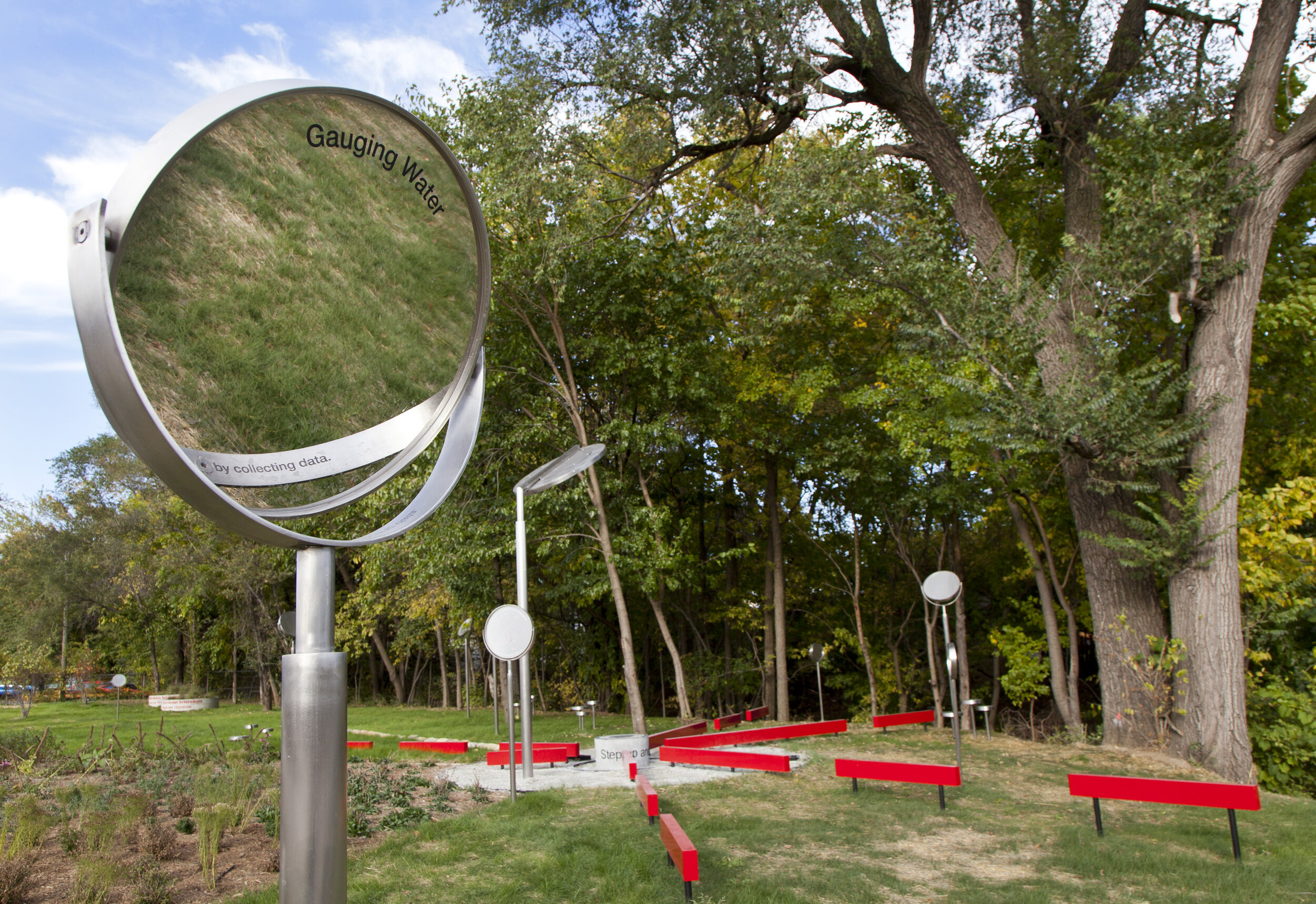
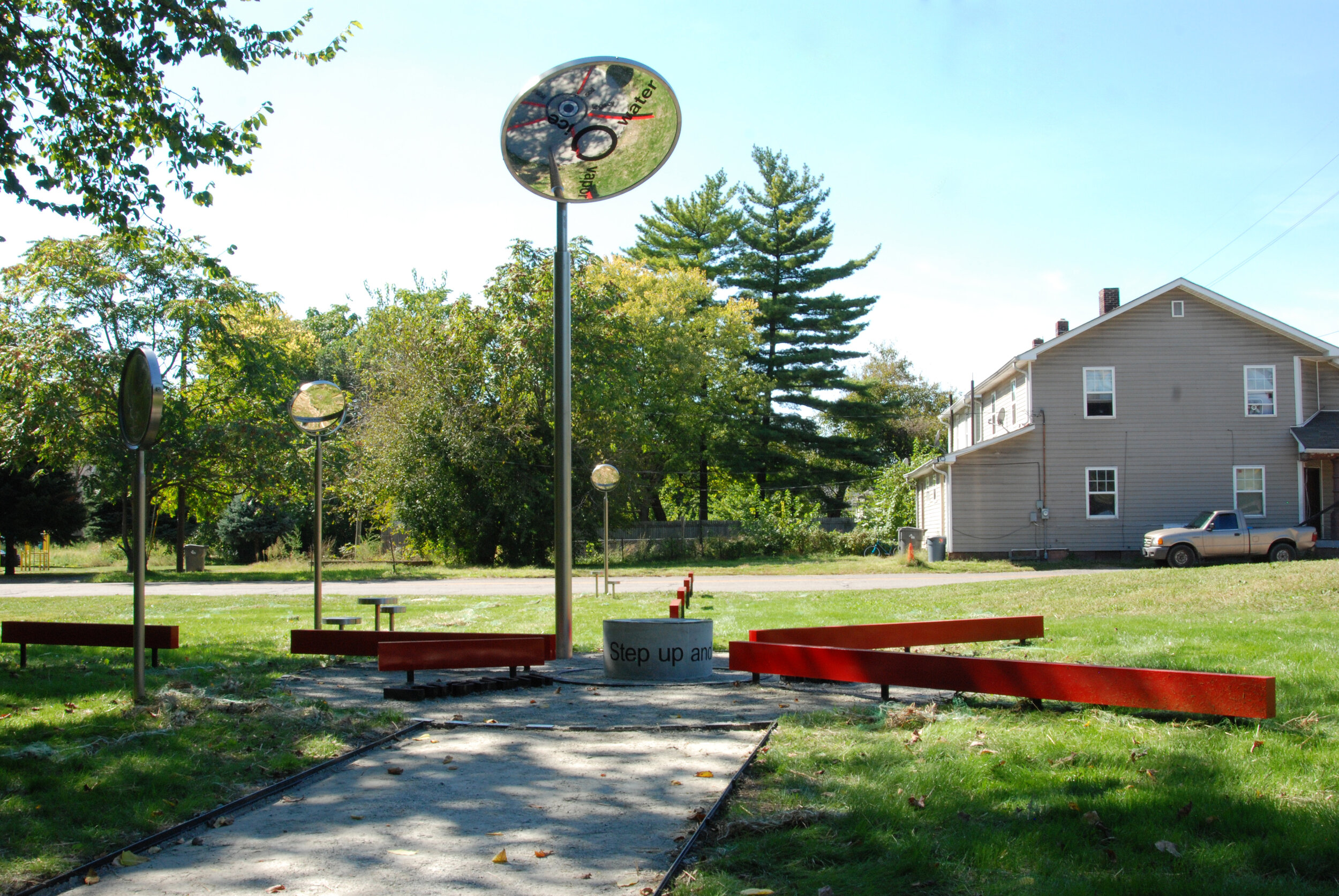
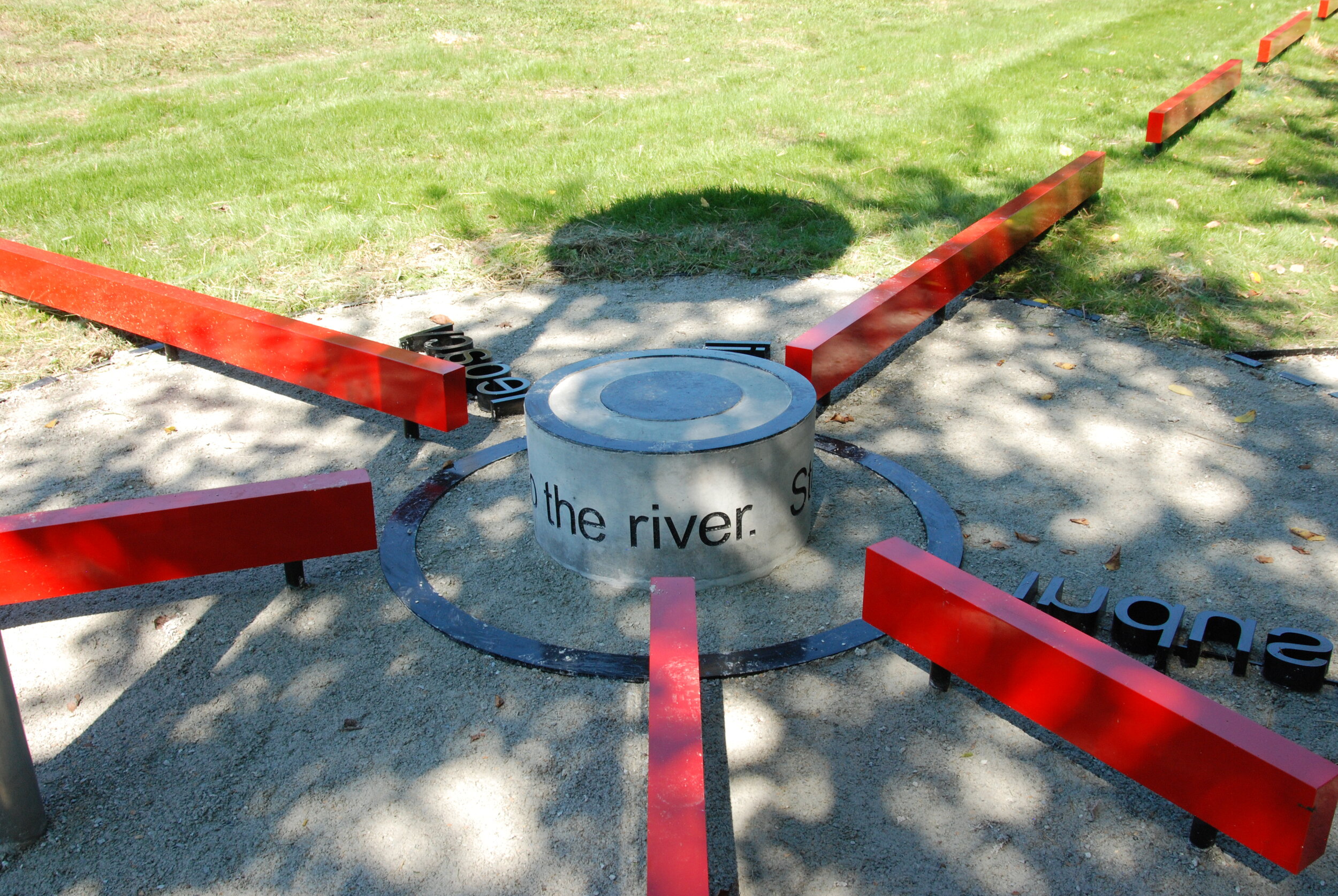
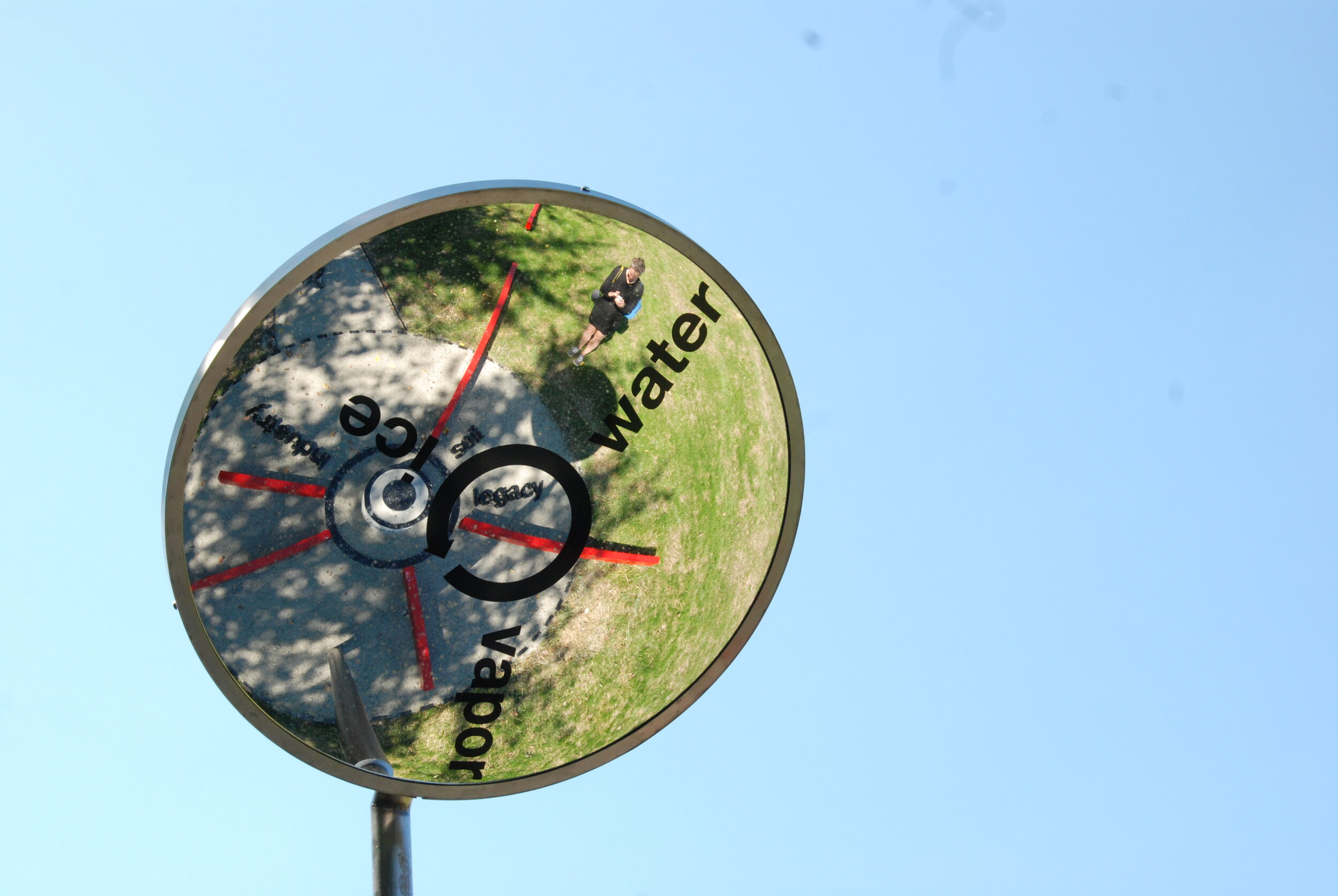
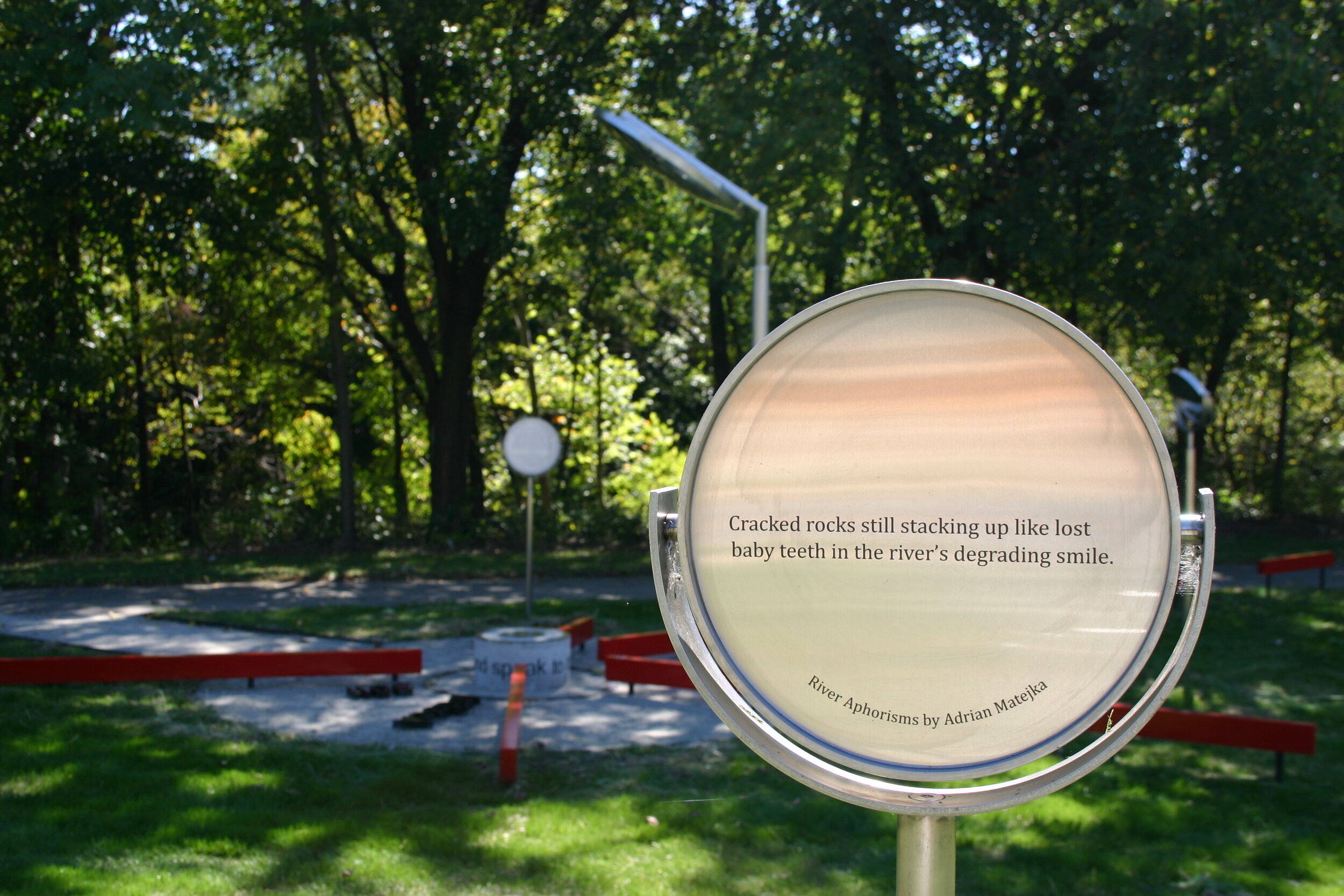
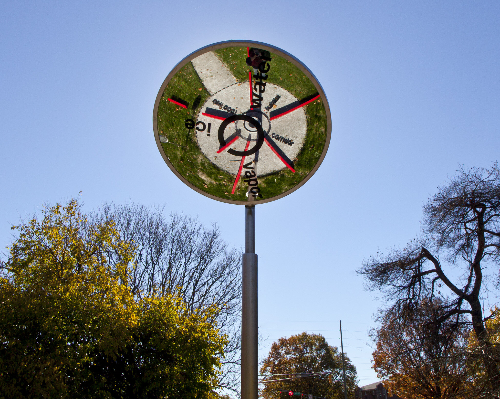
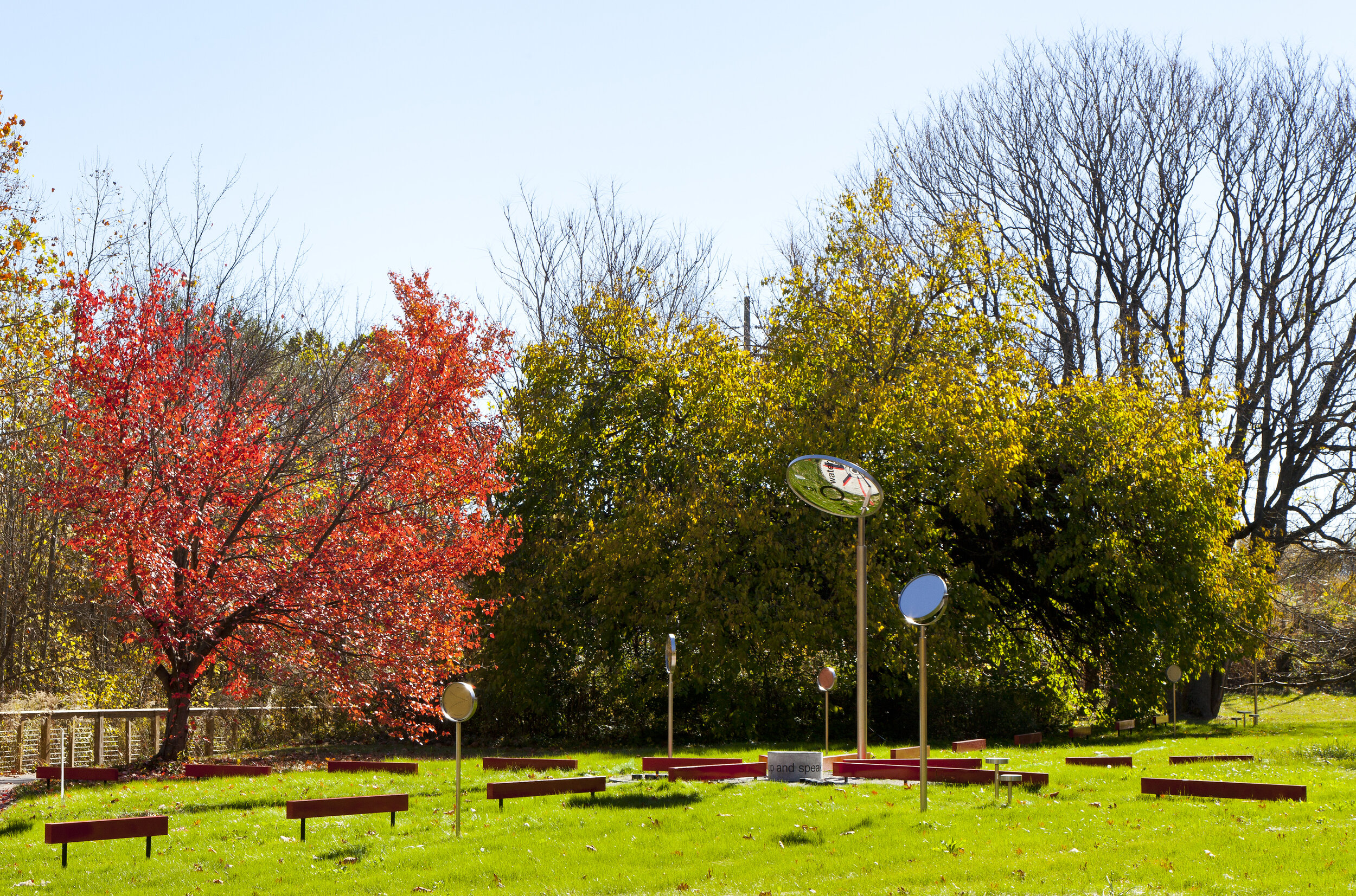
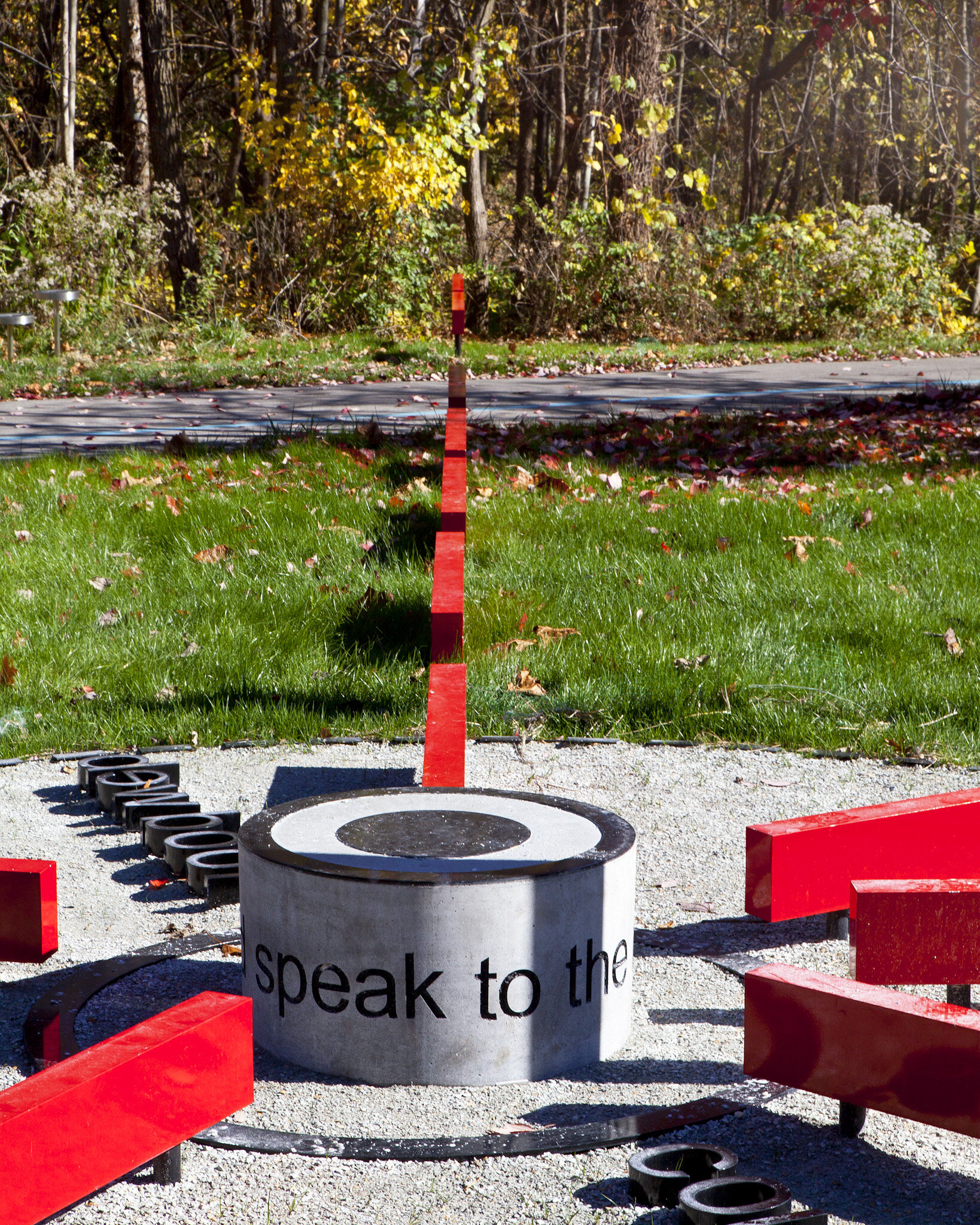
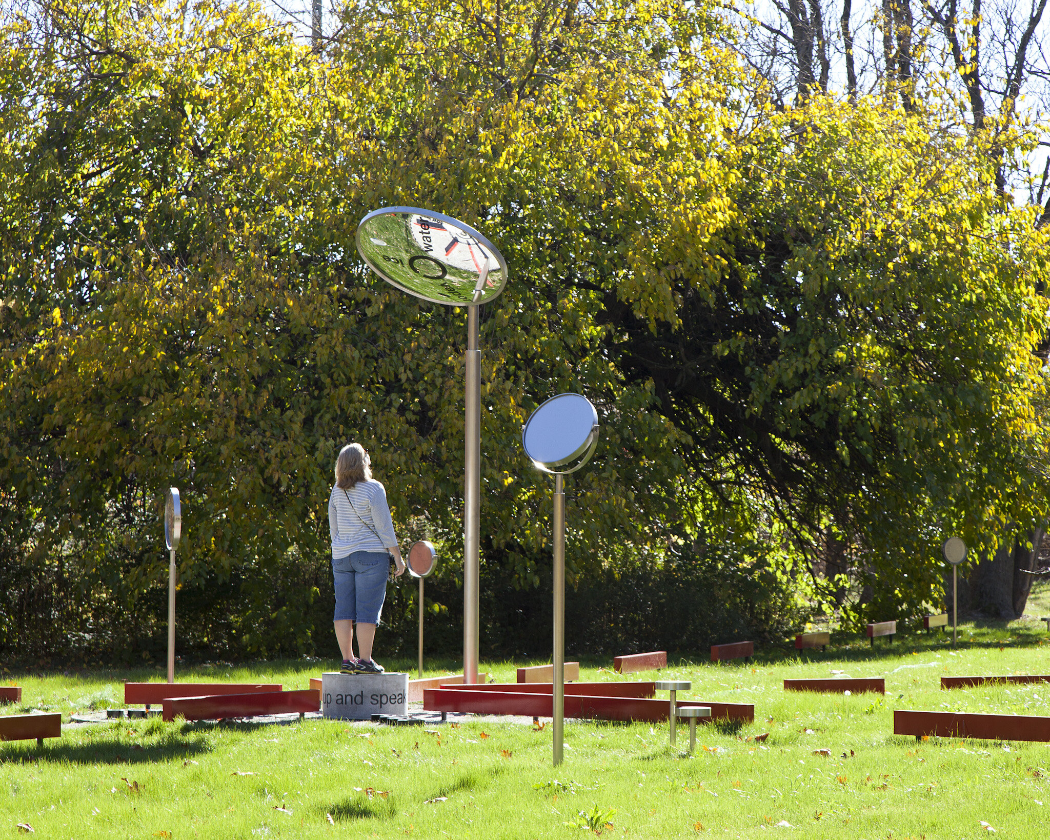
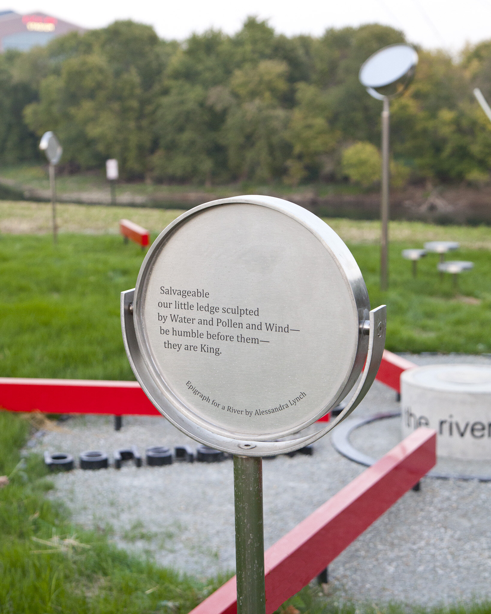
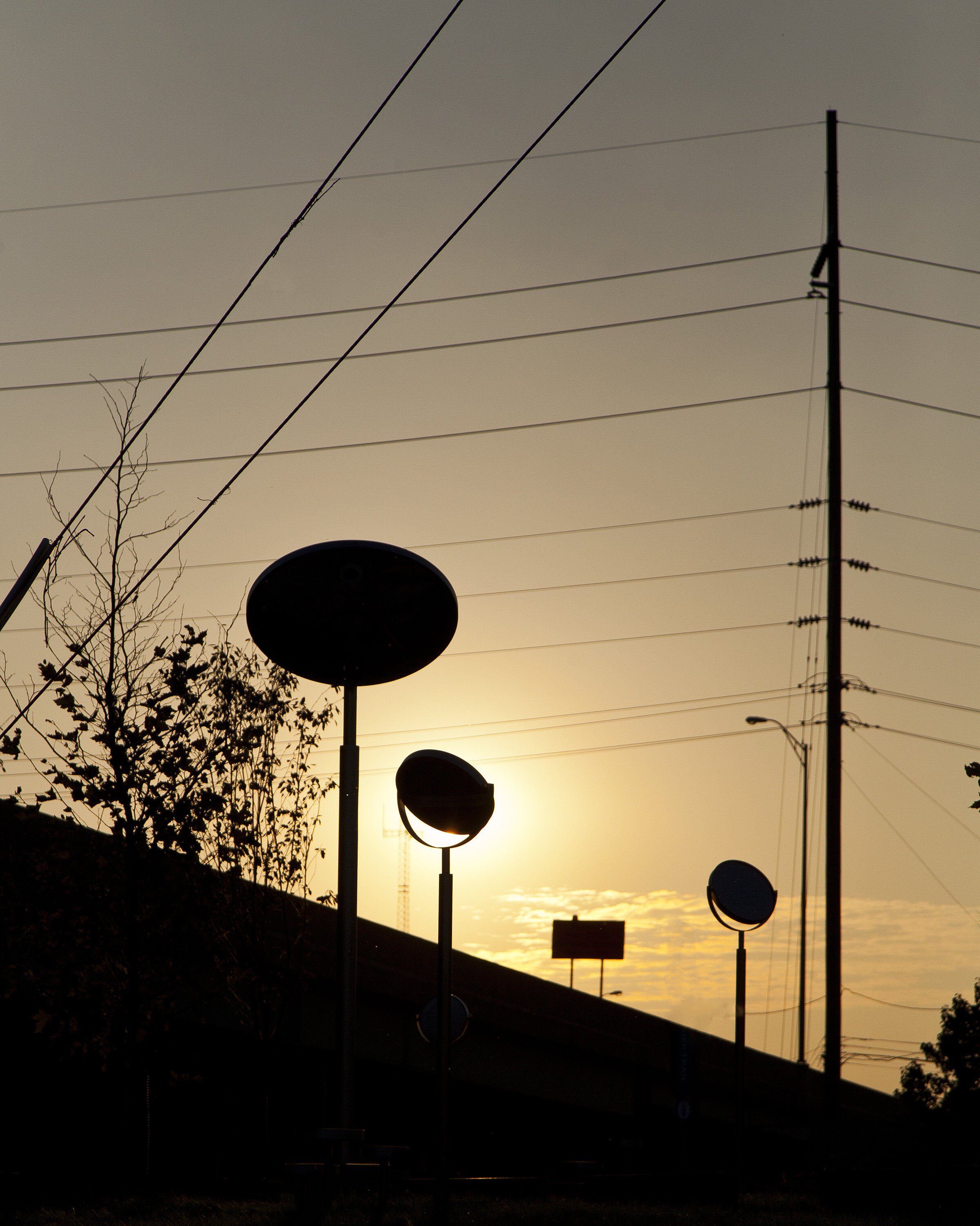
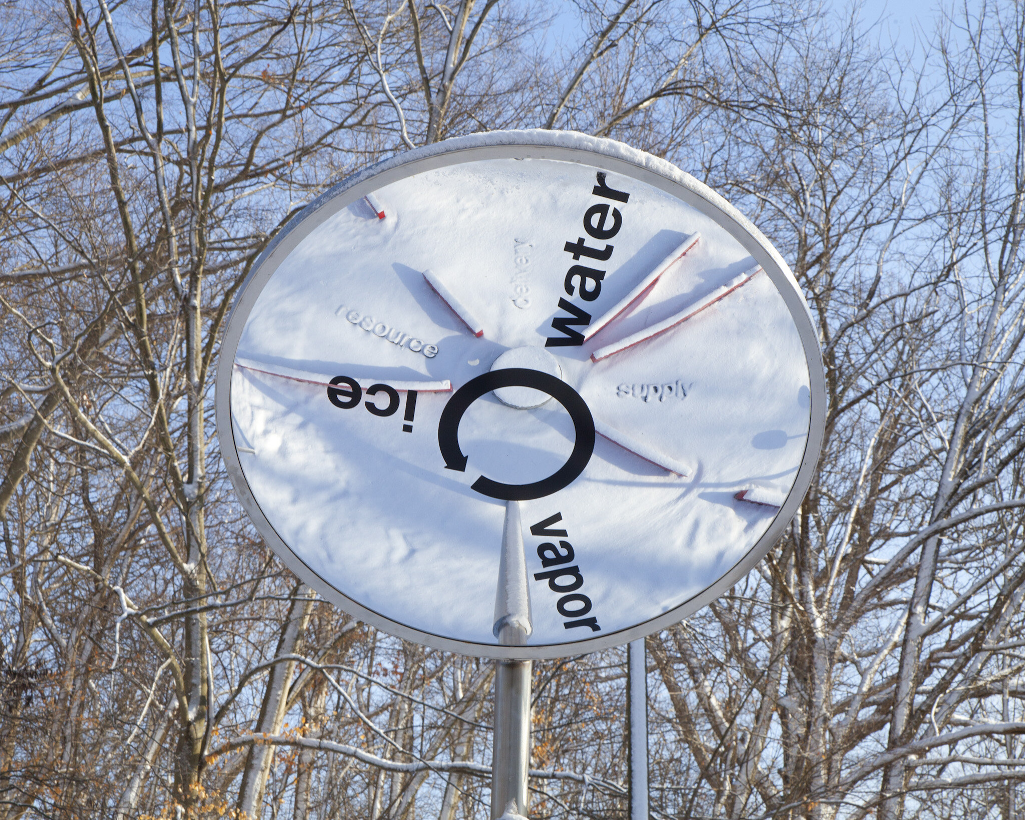
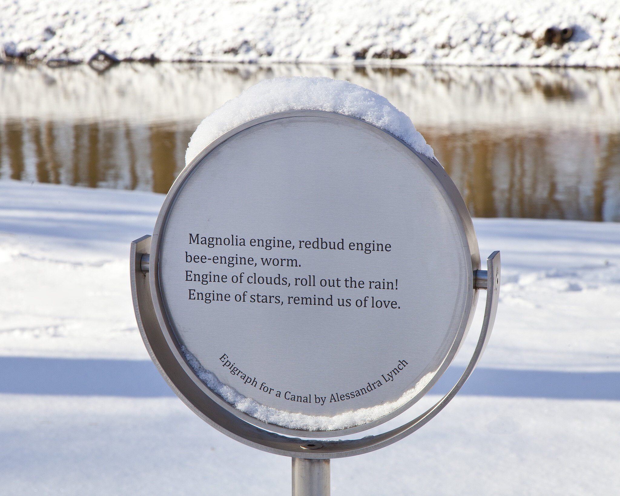
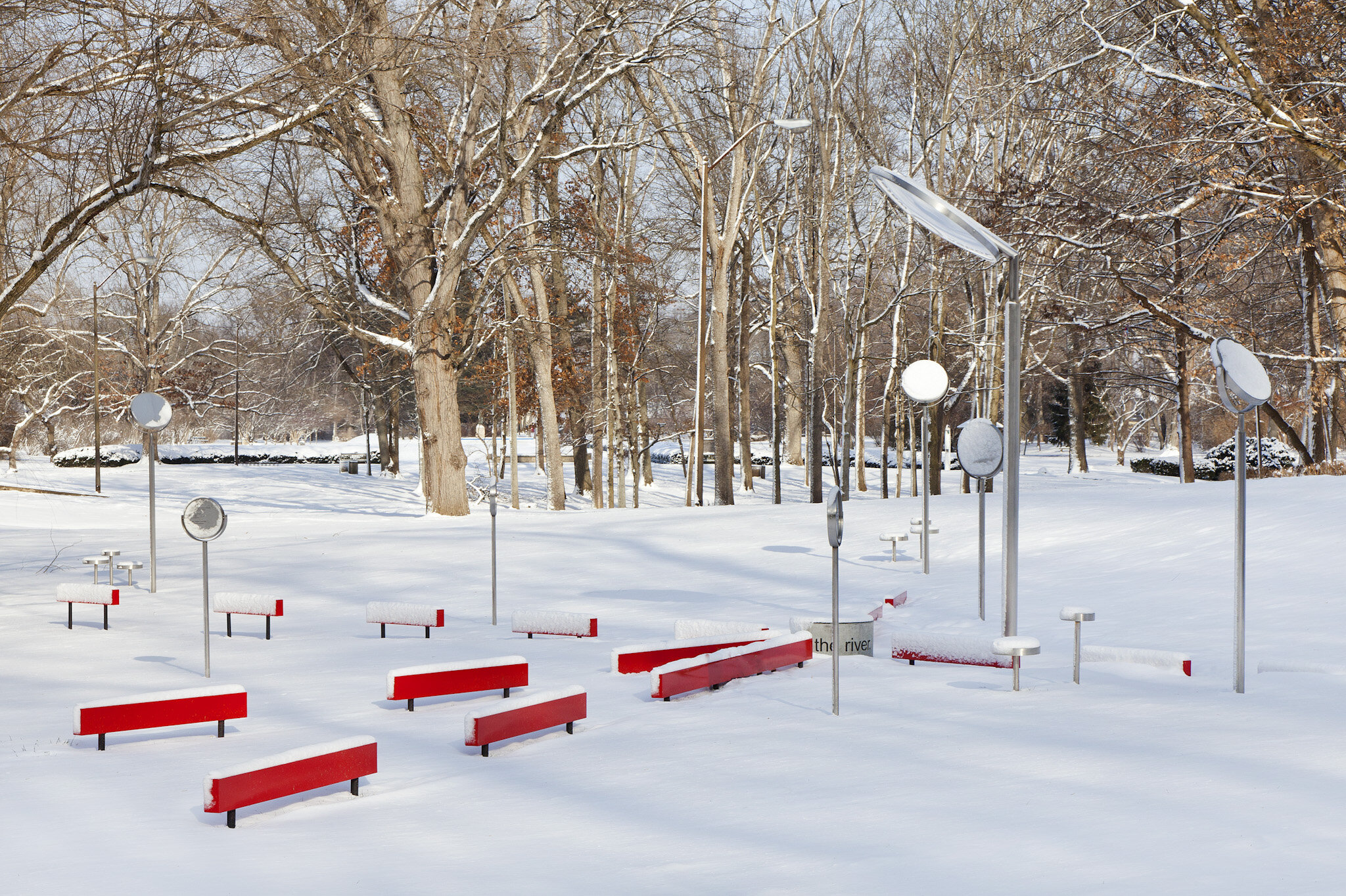
Each installation included a large mirror positioned above a concrete pedestal, and set in the middle of a 14’ diameter gravel circle. Stepping up onto the pedestal and looking up into the mirror, the visitor sees her reflection, the landscape behind her, and black 3-d words embedded in the ground below. Red “balance beams” drew the viewer’s attention out into the surroundings, encouraging a physical exploration of the site and mental reflection on the connections between water and our daily lives. Text on the sites includes poetry, scientific and historical facts, riddles, jokes, prompts, and questions. The text also directs visitors to an app and website [streamlines.org] that enrich the potential for learning and engagement. Site themes address water and its many states in the environment, the importance of water to Indianapolis’ development and history, water infrastructure and the connection to the larger watershed.
Stream/Lines included programming such as music, dance and poetry, merging science and the arts to advance the community's understanding and appreciation of Indianapolis’ waterways. Composers Hanna Been, Olga Bell, Stuart Hyatt, Roberto Lange, Moses Sumney, and Matthew Skjonsberg created original musical works inspired by each of the locations. Choreographer Cynthia Pratt (Professor of Dance, Butler University) has also been commissioned to develop a series of new dances that will be performed by Butler Department of Dance students. Indiana poets Catherine Bowman, Alessandra Lynch, and Adrian Matejka penned original pieces for each site. Special public programs such as poetry readings, dance and music performances will deepen the engagement of visitors and neighborhood residents.

Installation Sites
Pogue’s Run / Holy Cross at Vermont Street
When we think of water infrastructure we think of pipes buried underground that supply and remove the water we consume. But what about the water that goes into constructing and maintaining the other amenities of modern life like energy, roadways, and electricity? How does water keep us moving from the human scale to the city scale? Pogue’s Run looks at water consumption, disposal through the Deep Tunnel project, and the water energy nexus. The installation at Pogue’s Run is extant.
Pleasant Run / Fountain Square South at Prospect Street
The industrialization boom in the United States helped advance the country economically and changed our lifestyles drastically. At the time we were not aware of, or chose to ignore, the environmental effects that would result from the manufacturing and processing of the resources that were helping to propel the nation. Industrialization helped to provide jobs, process raw materials that provided electricity for our homes and gas for our cars. Some of the unseen burdens to our environment can still be seen today. The legacy of our choices are visible in our infrastructure and through the layers of earth.
Fall Creek / Mapleton Fall-Creek at 30th Street
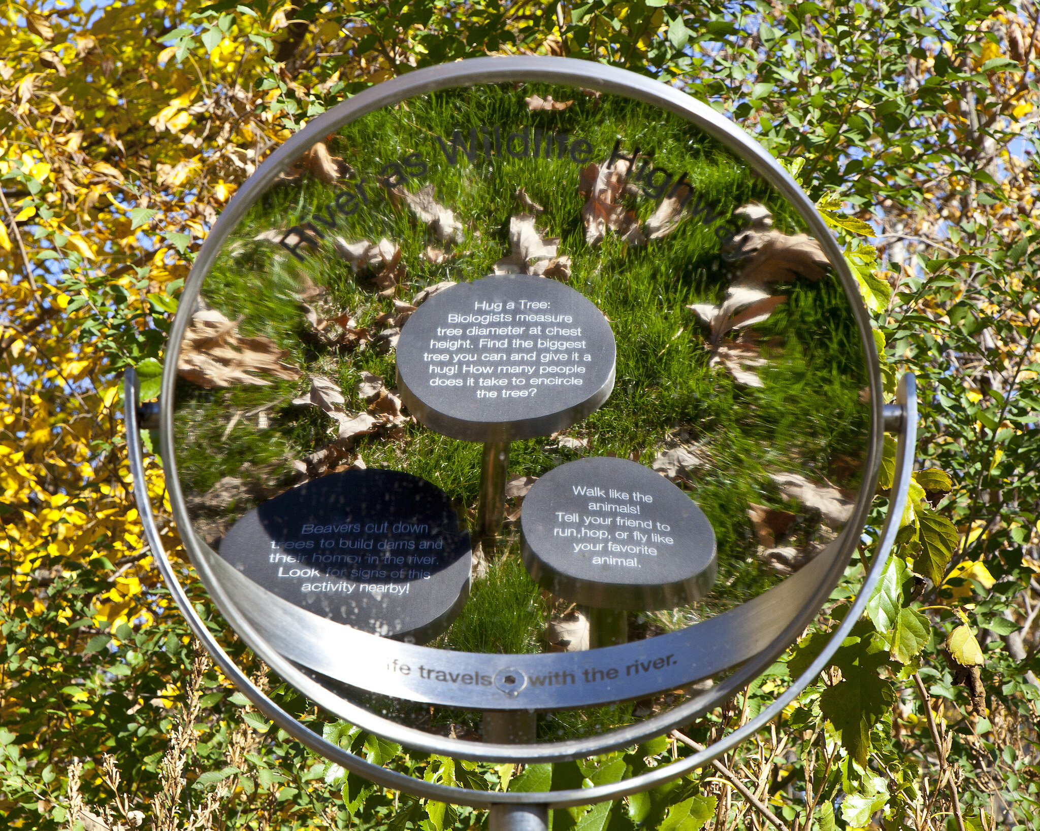
Imagine a Fall Creek Parkway specifically for egrets, sparrows, geese, turtle, and fish - dedicated habitat lane for native flora and fauna to migrate. Stream and rivers are the natural habitat super highway for plants and animals to not only live but move around the city and region. As streets and highways are a key component in moving the city and can affect the city’s health so are the estuaries of Indianapolis. Stream ecology and habitat health are vital in the city’s health.
White River / West Indy at Kentucky Avenue
The word atmosphere typically conjures thoughts of the sky, clouds, or images hovering above the clouds in the upper atmosphere bordering outer space. Weather, water, or what effect our human existence might have on our atmosphere is not typically thought of even though water is embedded in our weather vocabulary. Rain, precipitation, humidity, and storms are just a few commonly used words that are relative to water in our atmosphere. We understand that weather events can affect our daily routine – extreme weather can cause havoc on transportation systems, cause power outages, disrupt school days, and prevent crops from growing, just to name a few. What is not commonly thought about are the ways in which our population and the choices that we make are effecting and causing certain weather events. What is the different between weather and climate? What role does water play in the atmosphere and why is it important?
Canal / Butler University Campus
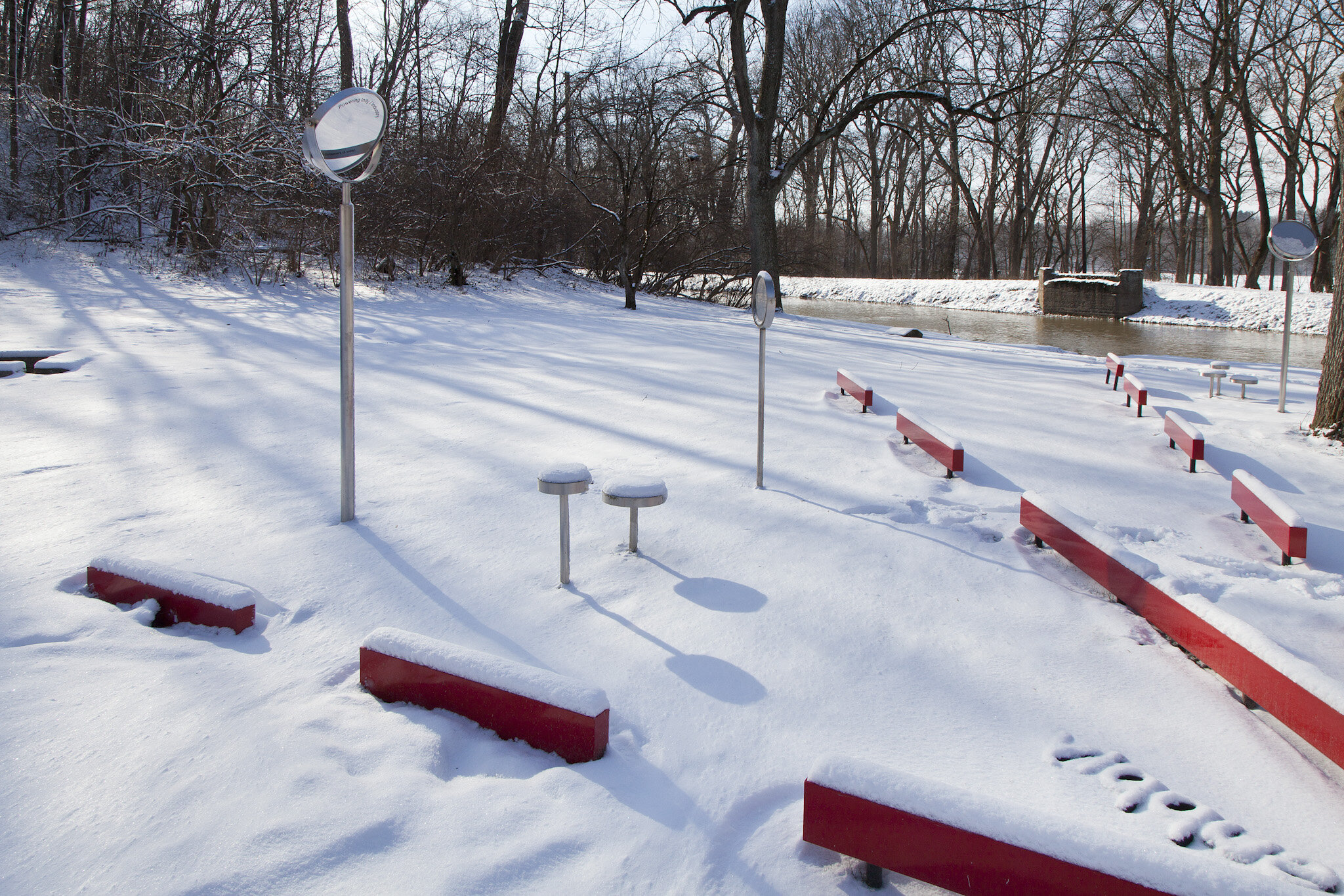
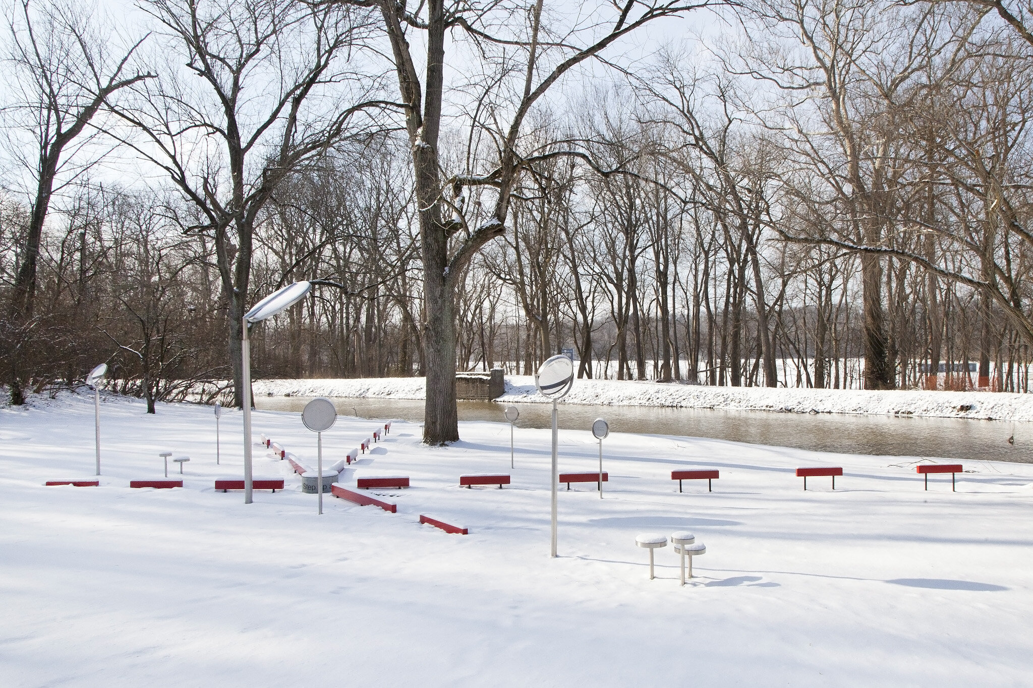

The Canal winds its way down from Rocky Ripple to downtown Indianapolis. On an initial look the Canal may appear to be a natural tributary with wildlife living in its waters and around its banks. On the contrary, the Canal is a living engineering relic that is deeply rooted in the political and economic history of Indianapolis that currently supplies the city with 60% of its drinking water. How and where does Indy get its drinking water? What role does the Canal play in the city’s water cycle? What are the regional connections upstream / downstream? And what is the water footprint of agriculture from upstream?