Connect the Dots, Boulder, Colorado, 2007

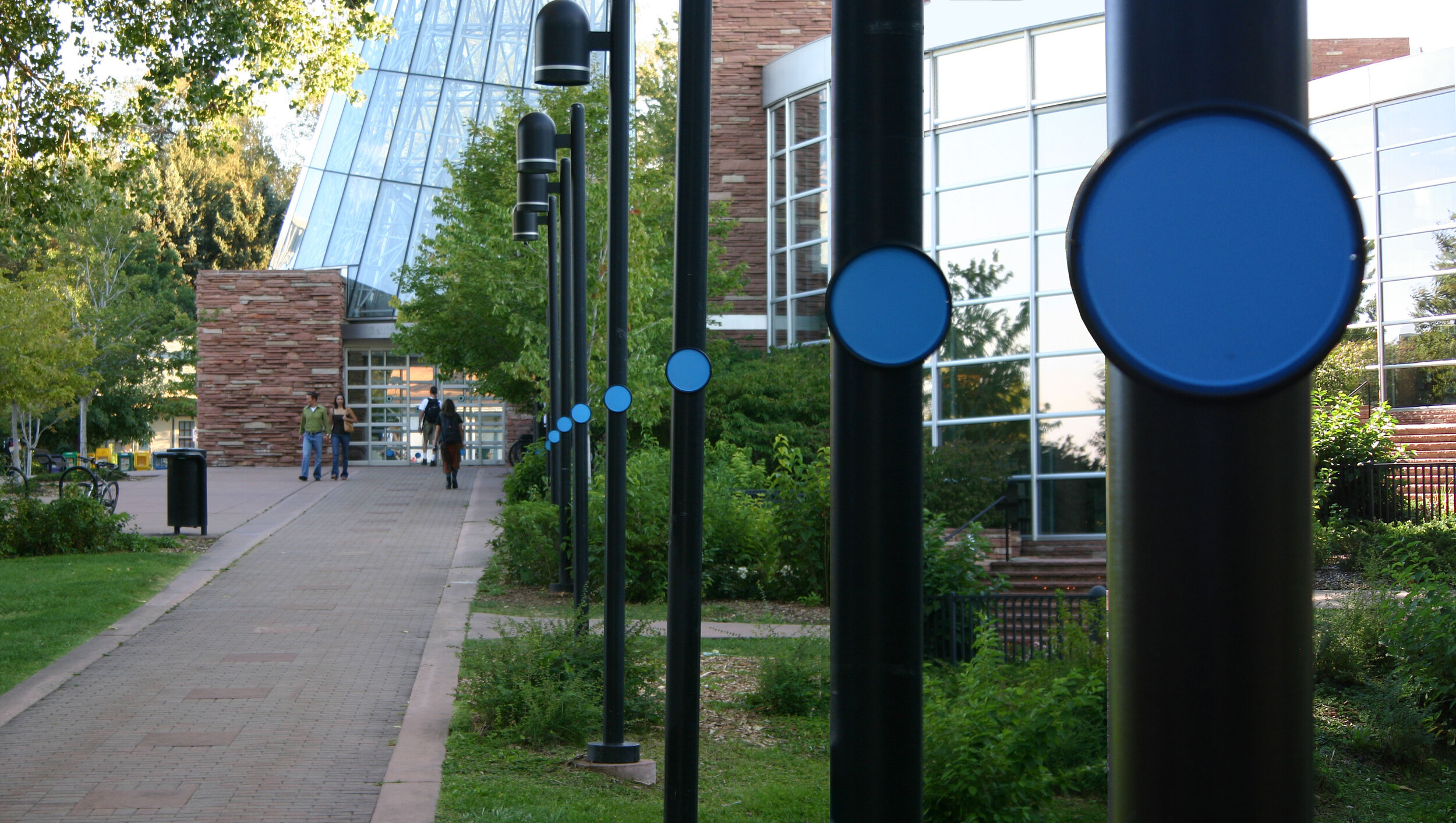
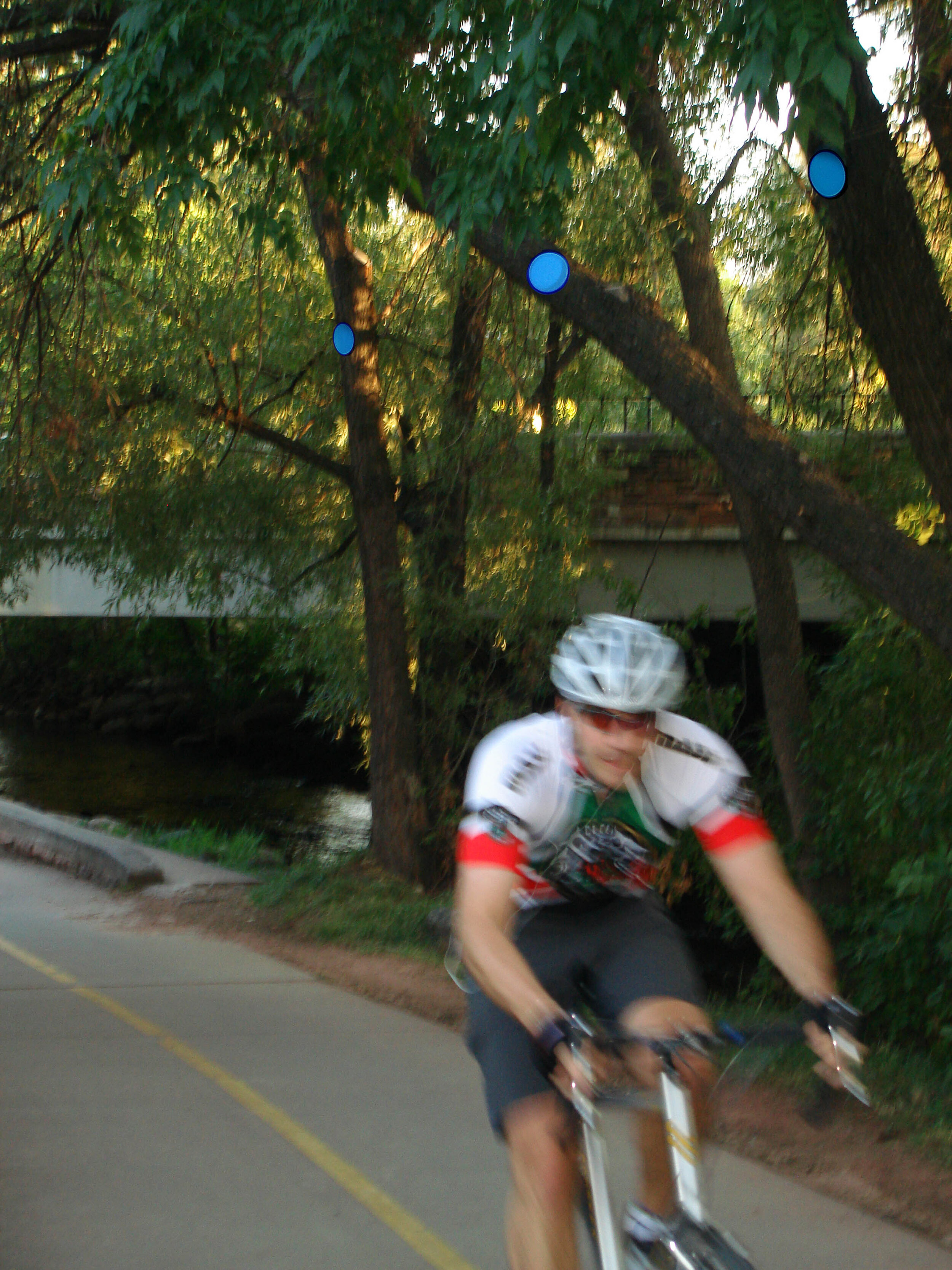
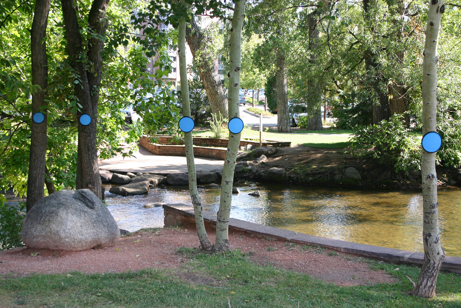
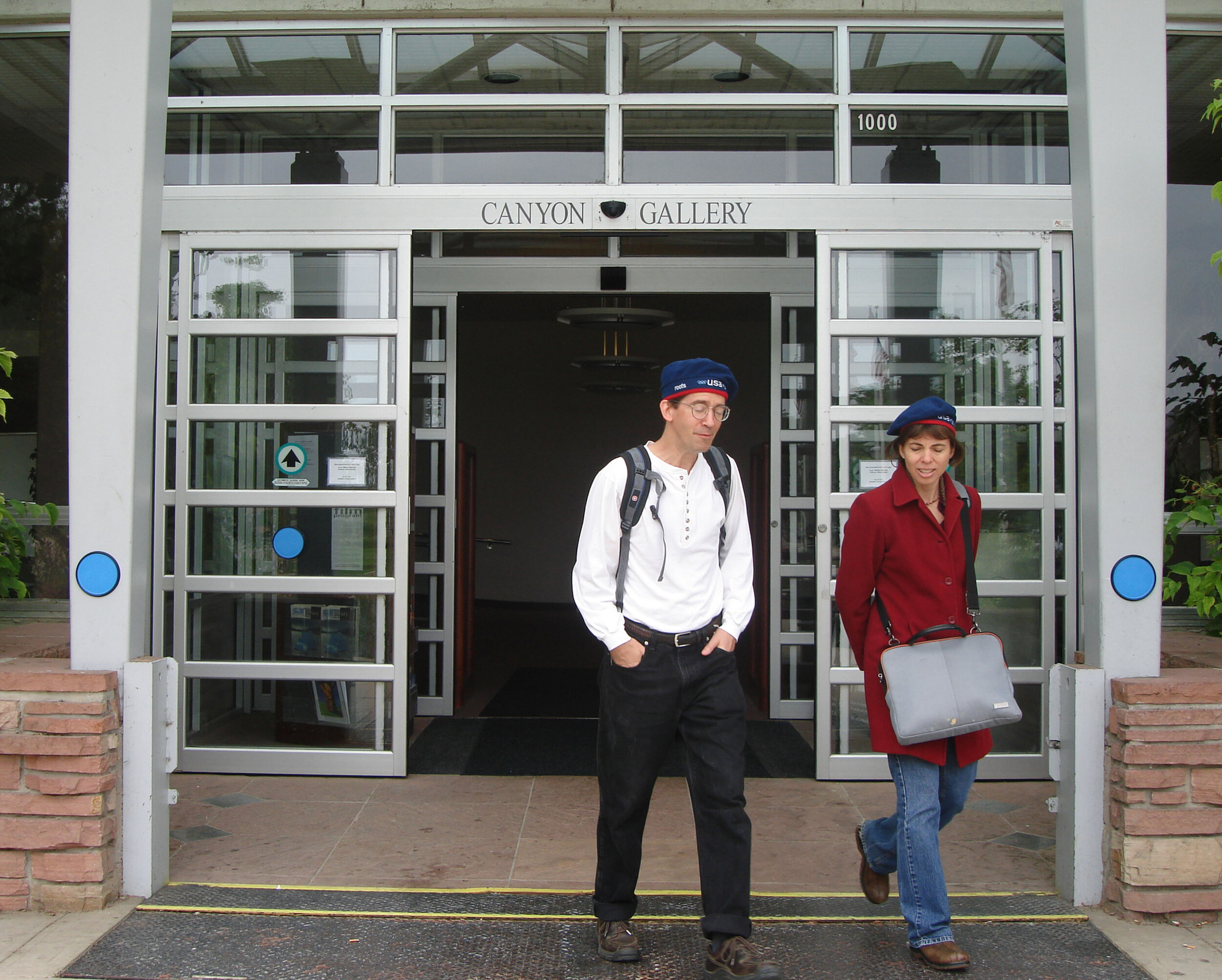
Connect the Dots in Boulder Colorado was a mapping project that made visible the flow and change of the geography. The project retold the story of the 1894 flood, an event outside of contemporary memory or experience, which inundated the city of Boulder, causing widespread damage. There is a 0.1 percent chance of a 100-year flood any given year, and a 0.2 percent of a 500 year flood occurring. It is even possible that those two floods could occur in the same year. New weather patterns make the forecasting of such events less predictable, however. The city of Boulder is located at the mouth of Boulder Canyon. Because of its location, the nature of the steep slopes and long approach upstream, the city is highly susceptible to flooding and is considered to be a high-hazard zone where the question is not if there will be a flood but when it will happen.
Connect the Dots brought the historic hazard back to present consciousness.
Using blue circular markers attached to trees and fences and important buildings in the floodplain, such as the Boulder Municipal Building and Boulder High school, to demonstrate the height of the water during the 500 year flood, Connect the Dots helps us imagine the catastrophic event.
To more fully reveal the nature and history of Boulder’s creeks floods, setting areas were created adjacent to the creeks, each focusing on single aspects of the creek. Steps and stairs along the creeks were marked to show seasonal water level changes.
Connect the Dots was not only focused on the flooding but considered how information about hazards can be communicated. A fully implemented project would deal with these points and others in detail; it would be an ongoing collection of information from experts in the field as well as from the residents of Boulder.